
372
FXUS66 KSGX 312358
AFDSGX

Area Forecast Discussion
National Weather Service San Diego CA
458 PM PDT Mon Aug 31 2026

.SYNOPSIS...
There will be cooling and drying for inland areas for early this
week with high temperatures cooling to around 5 degrees below
average for inland areas on Wednesday. Southwest to west winds for
the mountains and deserts during the afternoons and evenings will
gust to 25 to 35 mph through mid week. For next weekend, there
could be some influx of monsoonal and possibly tropical moisture
from an area of disturbed weather well to the south of southern
Mexico that may develop this week and track towards the
northwest.

&&

.DISCUSSION...FOR EXTREME SOUTHWESTERN CALIFORNIA INCLUDING ORANGE...
SAN DIEGO...WESTERN RIVERSIDE AND SOUTHWESTERN SAN BERNARDINO
COUNTIES...


...UPDATED AVIATION DISCUSSION...

Today through Wednesday...

Current satellite and 500mb analysis reveals the upper ridge
remains in control across the southeastern US with weak
southwesterly flow aloft across southern California. The further
displacement of the upper ridge allows for the continuation of the
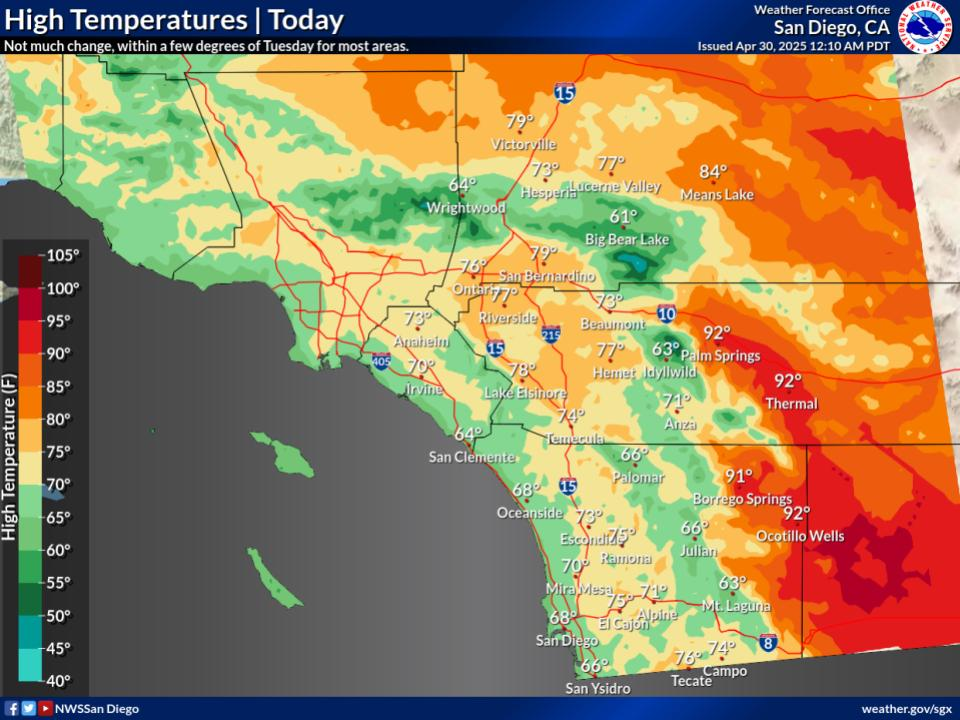
cooling trend observed through the last few days. High
temperatures this afternoon are expected to be about 3-5 degrees
cooler compared to yesterday. This has high temperatures running
around average to 5 degrees below climatological averages - a much
welcome change from the heat seen last week. Dewpoints and
humidity remain high for the coastal areas, keeping overnight
temperatures on the mild side while portions of the inland valleys
will be allowed to fall into upper 50s.

Moving into Tuesday, an embedded shortwave trough within a much
larger upper trough across the northeast Pacific is progged to eject
into central California. This will bring around 40 kts of southwest
flow at 500mb for Tuesday-Wednesday, leading to breezy conditions in
the mountains and adjacent deserts each afternoon. West to southwest
winds generally 25-35 mph for the mountains and deserts, locally up
to 45-50 mph within major mountain passes. While this is largely sub-
advisory or headline levels, the main concern will be elevated to
near-critical fire weather conditions in the mountains and deserts
where afternoon humidity is expected to fall into the 20-25% range
for the mountains and near 15% in the deserts. Temperatures will
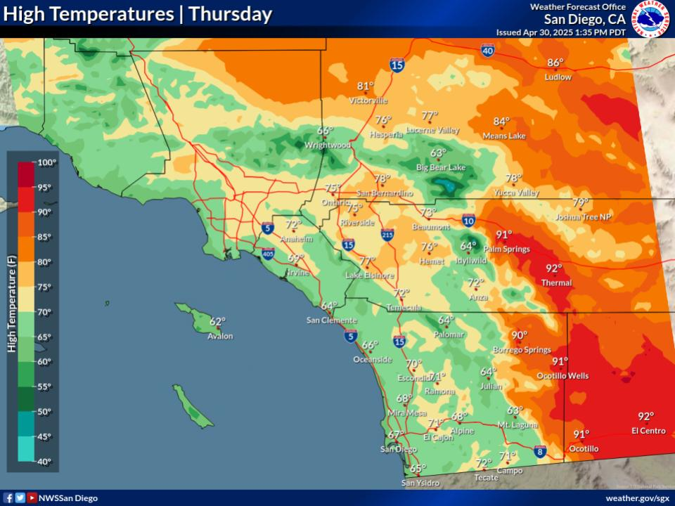
remain on the cool side through midweek, with highs a degree or two
cooler than today.

Thursday into early next week...

Following the shortwave passing through Tuesday/Wednesday,
southwesterly flow aloft stays in place as the large-scale trough
remains in place across the western US. This will likely keep the
below normal temperatures and breezy onshore wind in place through
the end of the week. However, the evolution of this large upper
trough and embedded shortwaves will play a pivotal role in the
steering flow of a potential tropical cyclone. This potential storm
is currently only Invest 95E as a cluster of disorganized
thunderstorms off the far southern Mexican coast. There remains a
significant amount of uncertainty in the expected evolution of
this system, especially as a storm has yet to officially develop.
The current spread of the grand ensemble favors 2 main clusters,
one with a more westward track out to sea, and the other as a more
northward track which could bring any remnants towards southern
California. Latest ensembles are favoring more of the westward
track, with only a ~5% chance of more direct/significant impacts
to the region. Despite this uncertainty and the potential track of
this storm, chances of precipitation increase as early as
Saturday evening with the potential for an influx of tropical
moisture aloft. Even still, plenty of cards need to fall in the
right way for this to occur, so stay tuned over the next few days
as the forecast becomes more refined and details become more
clear.

&&

.AVIATION...
010000Z...Coasts/Valleys...VFR this afternoon. Patchy low clouds
based 1500-2000 ft MSL will develop after 03Z this evening,
spreading into coastal SD Co 05-06Z and into inland SD and Orange Co
after 08Z. Coverage inland will be very patchy with intermittent
scatter out, with associated patchy vis reductions 0-5 SM where
clouds intersect terrain in elevated western valley terrain. Scatter
out 14-17Z. Clouds with similar bases develop and move inland late
Tues evening, possibly as early as 04Z but more likely 06Z onwards.

.Mountains/Deserts...Mostly clear skies today and tonight. Breezy
westerly winds mainly through mountain passes and desert slopes
through 07Z this evening. Gusts 25-40 kts with pockets of moderate
up/downdrafts over and in lee of ridges.

&&

.MARINE...
No hazardous marine conditions are expected through Friday, except
for gusts around 20 knots expected each afternoon through Thursday
in the vicinity of San Clemente Island.

&&

.BEACHES...
A southerly swell from Hurricane Karina will maintain elevated surf
on south and southwest facing beaches with sets up to 6 feet today
and 5 feet Tuesday. Swells from tropical cyclones will continue
to arrive much of this week.

&&

.SGX WATCHES/WARNINGS/ADVISORIES...
CA...None.
PZ...None.

&&

$$

PUBLIC...Munyan
AVIATION/MARINE/BEACHES...CSP
NWS San Diego (SGX) Office


 6800ft.




 © bensweather